Kilskeagh Church and Graveyard
At Rathfee, Co. Galway, the ruins of a medieval parish church and its graveyard lay hidden under fifty years of scrub. Since 2023 a community effort has brought the site back into the open — and revealed far more than a church.
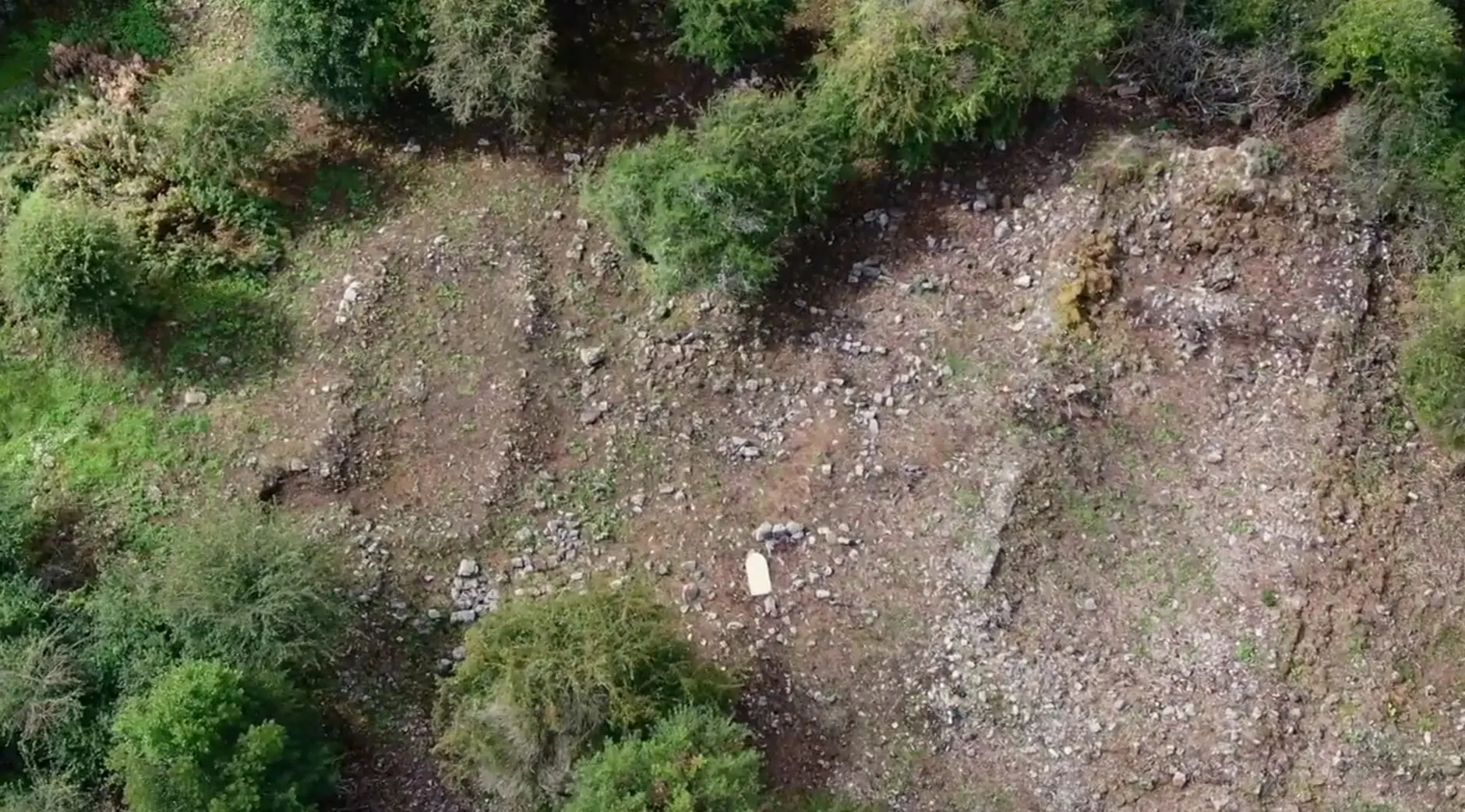
Rediscovery, 2023
The old church and graveyard at Kilskeagh — recorded in the national Sites and Monuments Record as GA071-076003 — lived on in community memory, but by the 2020s it had been completely obscured by natural overgrowth for well over fifty years. In 2023 John Tarpey set up the Kilskeagh Heritage Committee with the intention of uncovering the lost remains and making the graveyard accessible to the community once again.
With the assistance of a Heritage Council Community Heritage Grant, the committee commissioned an Archaeological Impact Assessment from Donna Gilligan of Scéal Heritage Consultancy and an Ecological Assessment from John Lusby. With those reports complete, permission to tidy the site was received from the National Monuments Service, and the committee and a team of volunteers were given a toolbox talk on best practice and regulations before any work began.
What followed was many hundreds of hours of voluntary work, under continuous archaeological supervision, clearing the thick scrub of hawthorn, whitethorn and briars that covered the site. Over the course of 2024 the core of the church and graveyard was cleared of the heaviest overburden — though the greater part of the roughly thirteen-acre core site is still concealed, and the full extent of the settlement is not yet known.
His work has also uncovered a previously unrecorded and very significant wider archaeological and historical complex dating from the medieval period, which shines a new light on the important local history of the area.
The medieval church
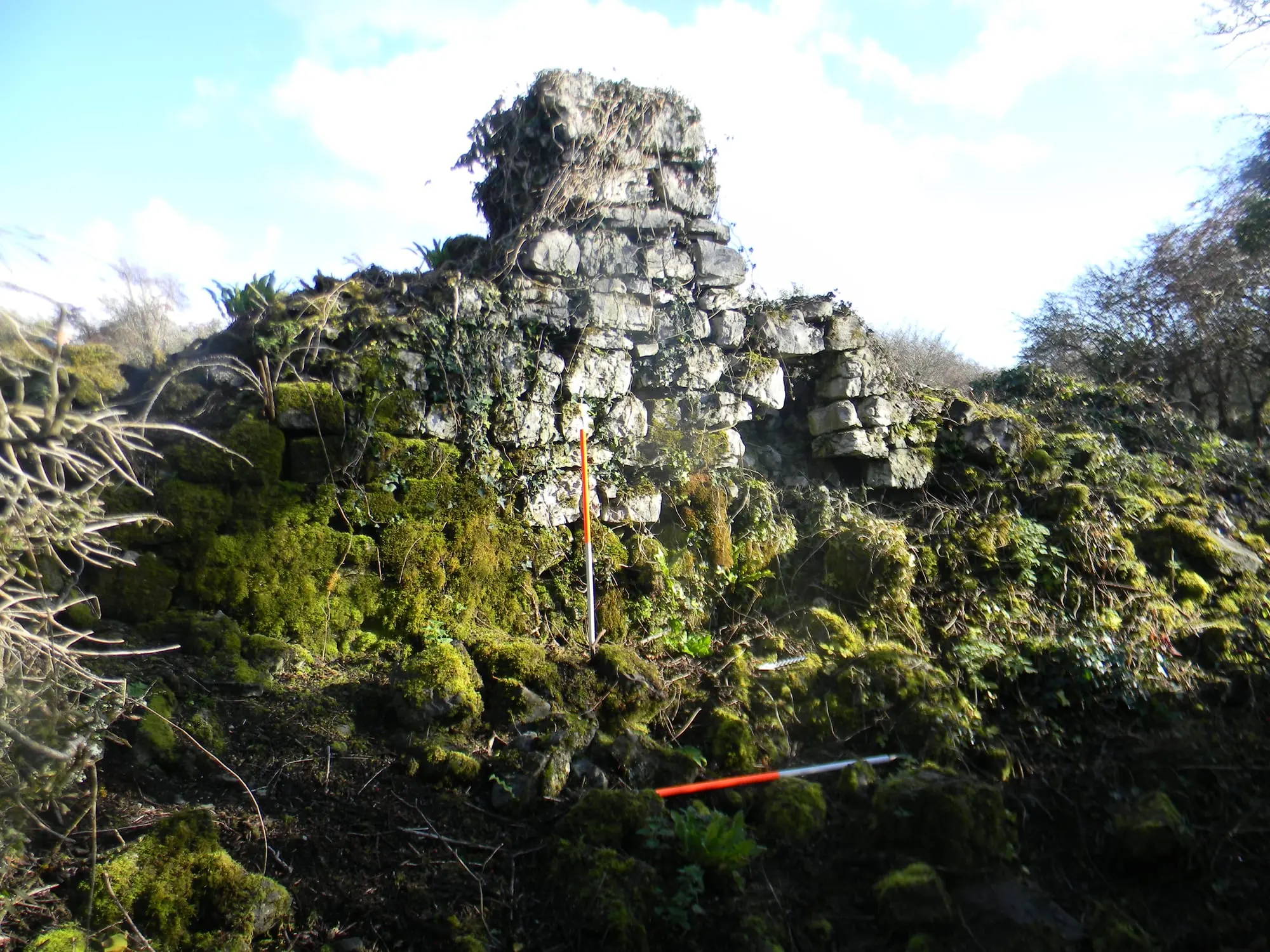
The surviving church is a substantial building, about sixteen metres by nine, and its stonework and layout suggest a parish church of the fifteenth or sixteenth century. The remains of the west wall are thought to have formed part of a vaulted room: the priest's living quarters within the church. Very few written records for the church have yet been found, so its background cannot be placed with certainty. An earlier church, most likely a simpler wooden building, would very probably have stood on the site for centuries before the stone one.
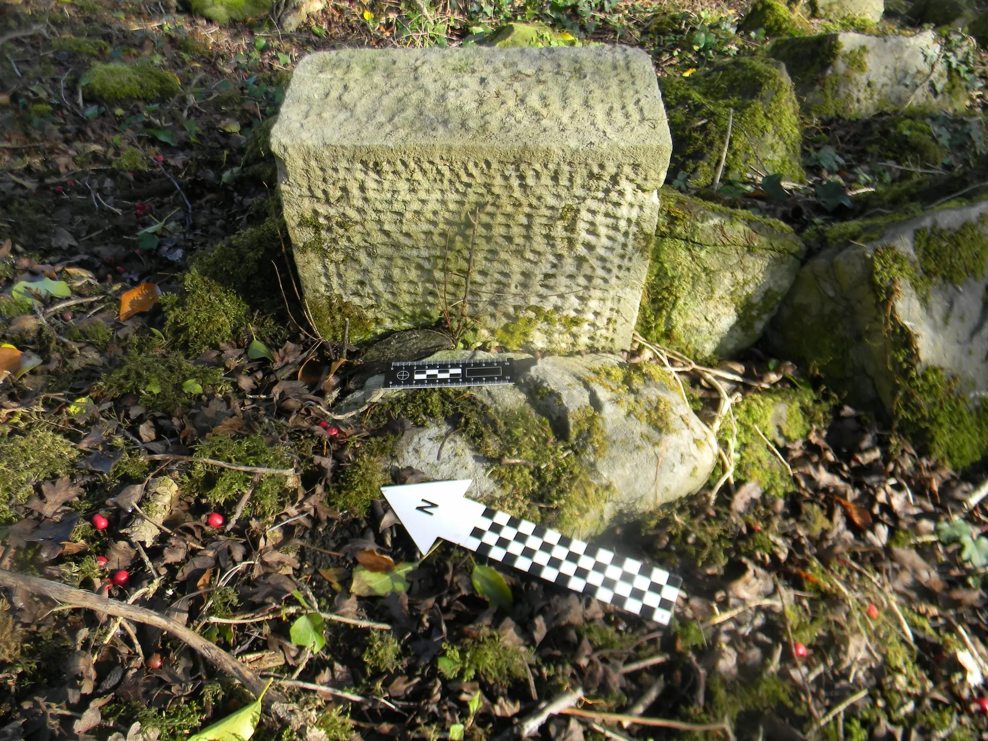
Here and there the church's own masonry has been given a second life. A small number of decorative punch-dressed stones — blocks finished with a pointed tool to give a dimpled surface — have been found reused as grave markers in the graveyard.
No diagnostic carved features survive in the walls today, and the church appears to have fallen into disrepair in the post-medieval period. The first edition of the Ordnance Survey records it simply as Kilskeagh Church in ruins.
The graveyard and cillín
South of the church lies the community graveyard. A large number of simple stone-lined graves of varying sizes are set closely together across the site. Only one inscribed grave slab has been found, dated 1797 — but the graveyard served the local community for well over two centuries, and in later years was reused as a cillín, with burials continuing up until 1960.
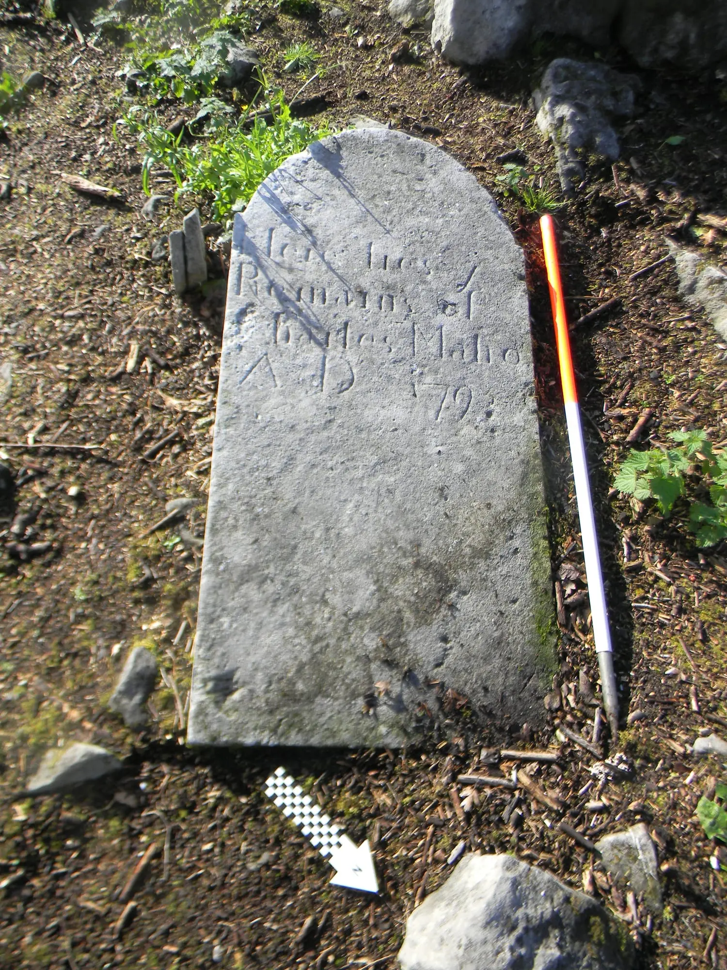
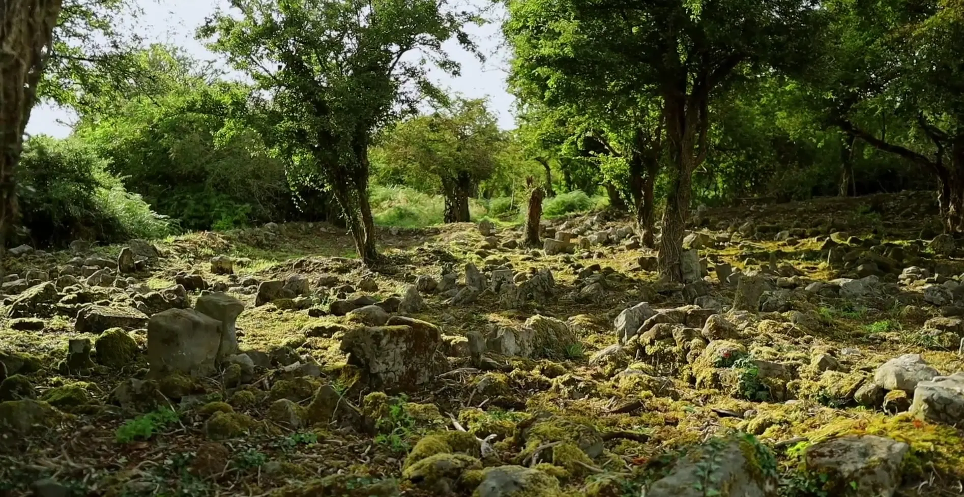
Because so few of the graves are marked with inscriptions, local oral history has been essential to understanding who lies here. As clearance continues, each visible grave within the cillín will be recorded.
A settlement around the church
The clearance revealed that the church did not stand alone. Structural foundations of differing sizes lie to the east, west, north and south of it. One, to the south, was already in the archaeological record; many more were not.
- A large circular structure, about eighteen metres across, behind the west gable of the church — still completely overgrown.
- A large rectangular building to the south-west, roughly six metres by twelve, with walls about a metre thick.
- Another rectangular building to the east, about seven metres by thirteen.
- A smaller structure to the north of the church walls, about 5.6 by 4.6 metres.
None of these walls survive above half a metre in height. In all, the remains of approximately thirty buildings appear to be present close to the church, and a proper survey will be needed to record their layout. Several are of an unusual form — rectangular with a circular projection at one end, the shape of a corn-drying kiln. Dr Christy Cunniffe, formerly Galway's community archaeologist, has suggested they may be unusual examples of barn kilns, a type otherwise seen in Scottish contexts such as Orkney.
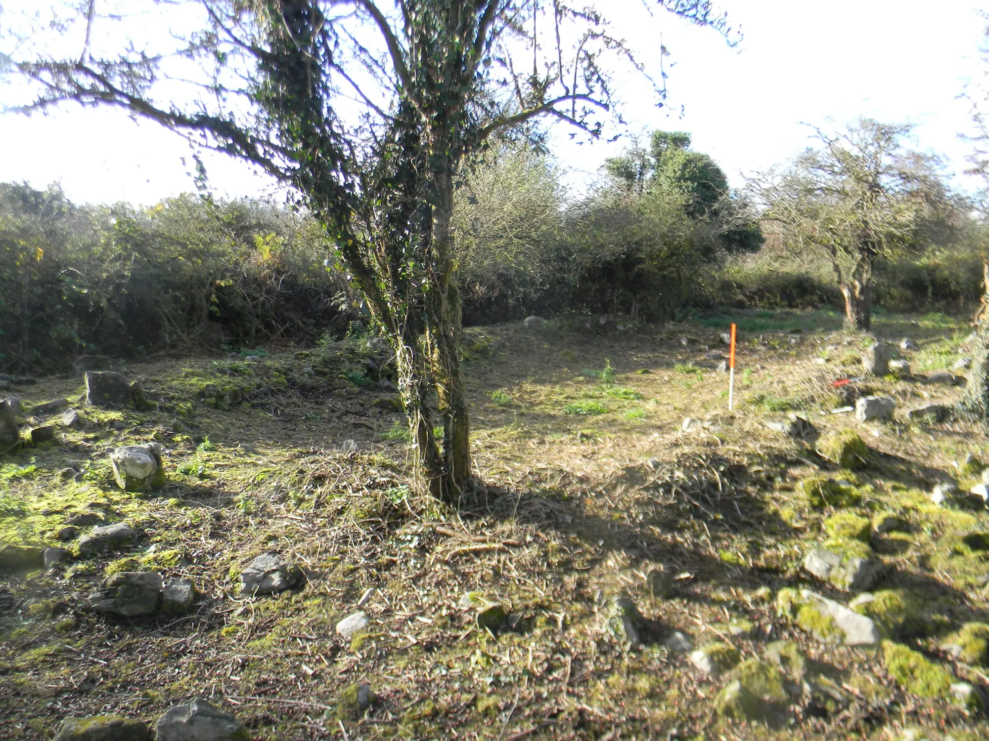
Taken together — the concentration of buildings, the folklore and the oral history — the site may represent the remains of a deserted village.
The market and the wooden cross
Kilskeagh is remembered in oral history as the site of a busy market for many years — held, local tradition says, every Friday — and some of the building remains may relate to that use. The earliest maps that show the ruined church also mark a wooden cross beside it — a market cross.
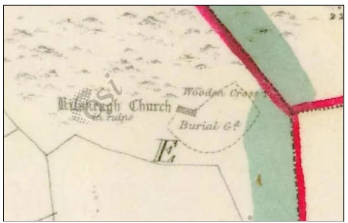
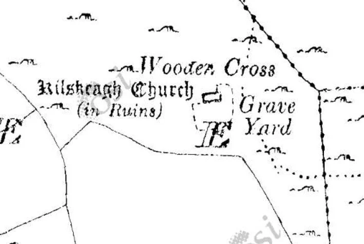
On the ground, the spot corresponding to the cross on the map holds four small to medium-sized grass-covered stone cairns close together. At least one of these may have been the base for the wooden cross, which no longer survives; what the others were for is not yet clear. The cross itself is recorded in the Sites and Monuments Record as GA071-076004. The other stone cairns around the site raise more questions than answers — could some of them cover burials, perhaps from the Famine years? — and will need proper investigation before anything can be said.
What the LiDAR survey revealed
In 2025, with support from the Heritage Council's Community Heritage Grant Scheme, the committee commissioned Western Aerial Survey, led by Dr Paul Naessens, to carry out an aerial survey of the site and its surroundings. A drone photographic survey was followed by a LiDAR survey — an airborne laser scan that can, in effect, strip away the vegetation to reveal the bare ground beneath. The drone was flown at a time when the vegetation was at its height, so the laser was the only way to see what lay under it.
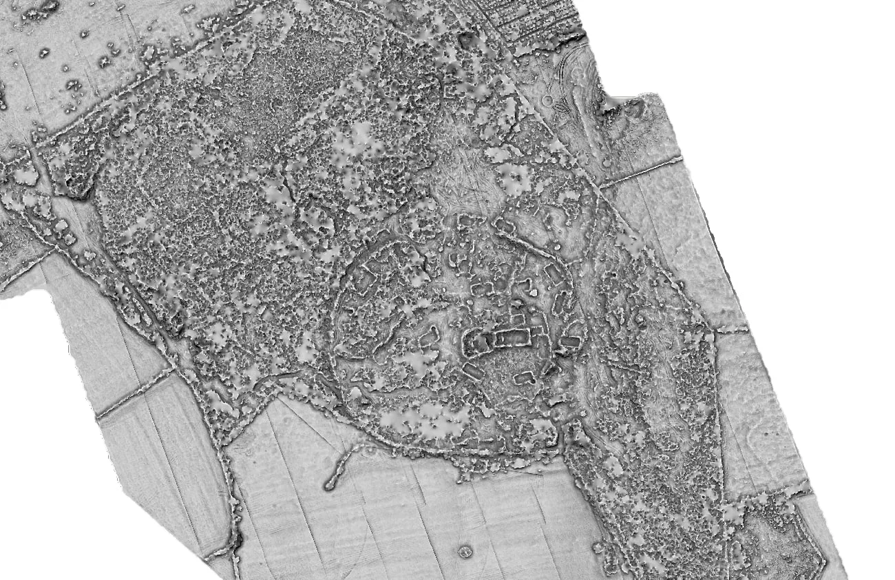
The most significant discovery was a substantial round or oval bank enclosing the entire core of the site. It measures about 125 metres across in both directions, with the bank surviving for roughly three-quarters of its circuit, standing on average 0.4 metres high and two to three metres wide. Enclosures of this kind are characteristic of early medieval church sites — it may be one of the concentric enclosures associated with early monasteries — and point to an origin for Kilskeagh far earlier than the standing church.
There is another possibility too: that the church was built within the reused enclosure of an earlier ringfort. The townland name, Rathfee, has been suggested to derive from rath faoi — under the rath.
Within the enclosure the survey picked out a number of other building footings, while across the wider landscape it recorded at least three further enclosures, possible ancient field boundaries, and traces of former habitation. The preliminary results were presented to the public at an event in a local community centre during Heritage Week in August 2025.
The Witch's Castle
Some seven hundred metres to the south stands the Witch's Castle, a thirteenth-century hall-house, marked on the first Ordnance Survey as Witches Castle in ruins. The LiDAR survey revealed significant earthworks around it to the north, north-west and west — partly the remains of buildings that may be contemporary with the castle, partly perhaps quarrying for its stone — and a trackway running from the castle towards the church enclosure, past an oval enclosure (GA071-048) about 160 metres north of the castle. A further complex of enclosures and banks lies to the south of the castle, invisible at ground level since the fields were levelled, but clear in the survey.
Dr Naessens suggests a tentative sequence. The enclosure is the earliest element, possibly an early medieval monastic site. The castle came in the thirteenth century, perhaps occupied by a minor Anglo-Norman lord, and the church site may have been developed as the focal point of the parish in the thirteenth to fourteenth centuries, with the present stone church following later. Another possibility is that the castle was a grange castle of the Cistercian order before the order moved its core settlement to Abbeyknockmoy. The castle is recorded as occupied in the sixteenth century by one Murrogh McSwyne.
Origins and ongoing research
Dr Breda Lynch, a historian of the Cistercian order in medieval Ireland, was consulted on whether Kilskeagh might have been a grange — an outlying farm — of Abbeyknockmoy. Her research now suggests that the church site formed a distinct pocket of land within, but apparently separate from, the abbey's surrounding holdings, which makes a grange less likely, though it cannot yet be ruled out. What is clearer is the extent to which Cistercian landholding and farming shaped the surrounding landscape. A connection between Kilskeagh and the medieval diocese of Annaghdown has been established; its nature, and what it means for the history of the church, is the subject of Dr Lynch's continuing research.
Excavations in the wider area
The site does not stand in isolation. Commercial excavations by Rubicon Archaeology for the M17 Galway to Tuam and N17 Tuam Bypass schemes uncovered, at a site known as Kilskeagh 3, a small Neolithic penannular enclosure with a stone-lined cereal-drying kiln built into its internal mound in the later early medieval period. Excavations at Kilskeagh 2, 4, 5 and 6 found a post-medieval vernacular building, three cobbled trackways and two metalled surfaces, possibly linked to the Old Kilskeagh village remembered in oral history. The excavator, Brian MacDomhnaill, has suggested that these settlements, along with nearby Annagh, were abandoned during or shortly after the Great Famine.
Oral history
Since 2023, local oral history has been an extremely important means of understanding the site. Local people have provided information that matched what was later found on the ground — most of it previously unrecorded. This is especially true of the graveyard. The archaeologists working nearby in 2011 made the same observation: local knowledge identified houses and pathways as a former village before the archaeology confirmed it.
The older people of the village described the kind of grave markers that would be found — simple pointed stones — and they were found. They said there were the ruins of a church, and there were. Folklore placed a town outside the enclosure, and the search for graves kept turning up the remains of buildings that folklore had said were there. Families carry their own memories. One relative recalls coming to the site with their father more than twenty years ago and crawling through the scrub to find the family grave; another remembers a mother's story of twin brothers who died and were brought to Kilskeagh by horse and cart, at a time when the graveyard had no entrance and was known to the younger generation only from talk.
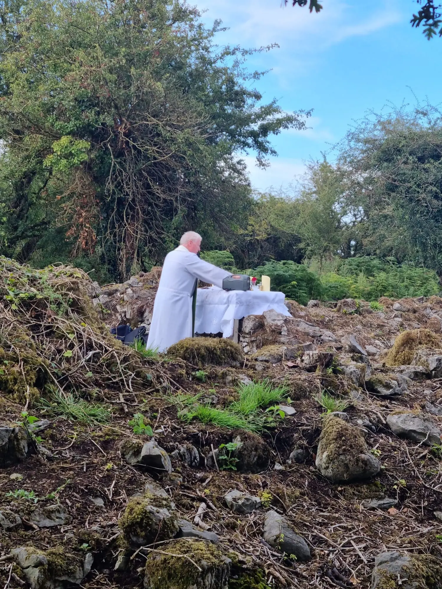
The written folklore record reaches back further. In the Schools' Collection of 1937, a local contributor wrote that Kilskeagh Church stood until Cromwellian forces attacked it. The committee had that line in mind when Mass was celebrated among the graves again — by that reckoning, the first Mass at Kilskeagh since Cromwellian times.
A family buried here, a story about the market, a name for a field or a building — every detail helps. Get in touch and we will record it.
What happens next
The whole site needs continued research to establish its true scale. Planned work includes further clearance, with recording, photography and LiDAR as each new area comes into view; integrating the survey observations with the archaeological and historical records, and checking key anomalies on the ground; a conservation plan for the church building, which is under way under the guidance of Martin English of the ACP Group; and recording of every visible grave in the cillín. Western Aerial Survey has continued to support the group on a voluntary basis, and community involvement remains central to interpreting and preserving what has been found.
Only around a tenth of the site has been worked on so far, and this year's work has cost over €5,000, met by local donations and volunteer hours. The committee's GoFundMe campaign helps keep it going — see how to support the work.
Sources and acknowledgements
This page draws on two reports commissioned by the committee, and on the committee's own recordings:
- Donna Gilligan, Scéal Heritage Consultancy — Summary of Kilskeagh Church and Graveyard, Rathfee, Co. Galway.Download the summary (PDF)
- Dr Paul Naessens, Western Aerial Survey — Kilskeagh Church, Graveyard and Castle Aerial Survey: RGB and LiDAR Technical Survey Report, 2025.
- Presentations by Donna Gilligan and Dr Breda Lynch, and interviews with volunteers and relatives, recorded at the Heritage Week information evening on 19 August 2026.Listen on the Media page
- Kilskeagh Heritage Committee, a short film in which the committee, the archaeologists and relatives of those buried here tell the story of the project.Watch it on the Media page
The committee is grateful to the landowners, without whose permission none of this work could have happened; to the Heritage Council (Community Heritage Grant Scheme), Galway County Council and its Heritage Office, the National Monuments Service, John Lusby Consulting, Dr Breda Lynch, Dr Christy Cunniffe, Dr Jim Higgins, Martin English of the ACP Group, Rubicon Archaeology, and above all to the volunteers who have given hundreds of hours to the site.
Photographs
Every photograph from the site. Select one to view it full size, or filter by subject.
No photographs in this section yet.